


's-Gravenvoeren
's-Gravenvoeren has developed as a ribbon village along the river Voer, with numerous footbridges over the water to the houses. The church, rectory and several farms in the immediate vicinity date back to the 18th century. That (Austrian) period was apparently a very prosperous time for this village.
Contact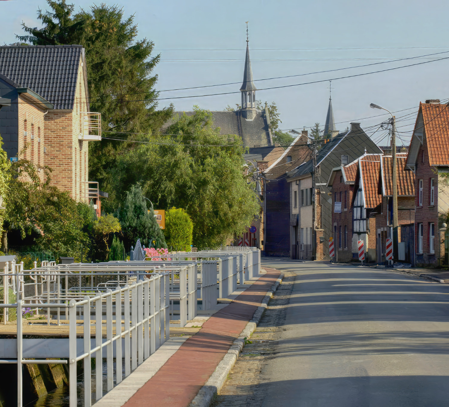
's Gravenvoeren
The central part of the village lies around the Pley from which Kloosterstraat goes west, Bovendorp goes east and Boomstraat goes south. This last street name probably refers to the Nagelboom van 's-Gravenvoeren, which is located nearby. St. Lambert's Church is located on the southwest side of the Pley. The Voer runs through the village, draining in a westerly direction and on which several water mills have stood. The Voer is also called the Koebeek on maps from 1930, after the first source stream in Sint-Pieters-Voeren. 's-Gravenvoeren is about 88 meters above sea level. To the north the landscape rises to the Margraten Plateau. Some sunken roads lead in that direction. About one and a half kilometers north of the village lies the Hoogbos on the northern slope of the Horstergrub, in the east lies the forest area Schoppemerheide. There is also the Altenbroek nature reserve in the northeast of the village, near the castle of the same name. In the vicinity of 's-Gravenvoeren you will find abandoned gravel, chalk, kieselois and silex quarries. Marlstone and silex were used as building materials for houses.
A piece of history
The central part of the village lies around the Pley from which Kloosterstraat goes west, Bovendorp goes east and Boomstraat goes south. This last street name probably refers to the Nagelboom van 's-Gravenvoeren, which is located nearby. St. Lambert's Church is located on the southwest side of the Pley.
The Voer runs through the village, draining in a westerly direction and on which several water mills have stood. The Voer is also called the Koebeek on maps from 1930, after the first source stream in Sint-Pieters-Voeren. 's-Gravenvoeren is about 88 meters above sea level. To the north the landscape rises to the Margraten Plateau. Some sunken roads lead in that direction. About one and a half kilometers north of the village lies the Hoogbos on the northern slope of the Horstergrub, in the east lies the forest area Schoppemerheide.
A very nice spot is the protected square of Kinkenberg, with the recently restored Chapel of Our Lady (1715). It is located on the north bank of the Voer at 100 m from the church. In the hamlet of Schoppem you will find the Steenboskapelletje. In 1846 a Roman villa was uncovered here.
The castle of the 'counts of Voeren' has long since disappeared. There are two other castles: Altenbroek (in the middle of a beautiful park landscape) and Ottegraven (on the border with Sint-Martens-Voeren). There is also the Altenbroek nature reserve in the northeast of the village, near the castle of the same name. In the vicinity of 's-Gravenvoeren you will find abandoned gravel, chalk, kieselois and silex quarries. Marlstone and silex were used as building materials for houses.