


Sint-Pieters-Voeren
Sint-Pieters-Voeren is a sub-municipality of Voeren, a municipality with facilities that is part of the arrondissement of Tongeren in Belgian Limburg, it was an independent municipality until the municipal reorganization of 1977.
Contact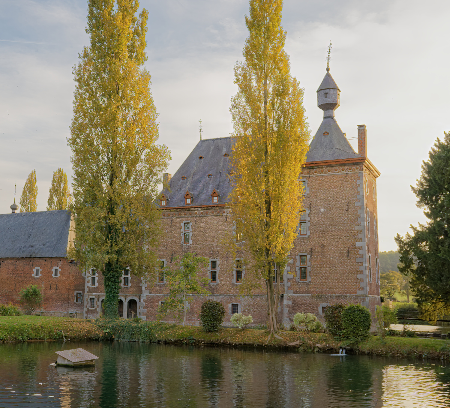
Sint-Pieters-Voeren
The smallest Voerdorp, with less than 300 inhabitants, is best known for its Commanderie. This castle belonged to the German Knighthood until the French Revolution. The current building was built at the beginning of the 17th century in the 'Maasland Renaissance', a style that we also often find in Liège and Maastricht In the park of the castle is the source, which supplies the ponds and the Voer with water with a flow rate of approximately 3,000 liters per minute. In the ponds trout (a typical regional product) and sturgeon are bred The village church was built around 1660 by order of Commander Willem Quaedt van Beeck, whose tombstone is located at the entrance gate of the cemetery.
Just outside the village (in the direction of Sint-Martens-Voeren) is the Sint-Annakapel from 1730, which is protected as a valuable monument. From the castle of Magis, on the border with Aubel, you have a beautiful panorama of the Voer region and on the other side of the road, the valley of the Berwijn and the Bel.
A piece of history
The smallest Voer village, with less than 300 inhabitants, is best known for its Commanderie. This castle belonged to the German Knighthood until the French Revolution. The current building was built at the beginning of the 17th century in the 'Maasland Renaissance', a style that we also often find in Liège and Maastricht.
In the park of the castle is the source, which supplies the ponds and the Voer with water with a flow rate of approximately 3,000 liters per minute. In the ponds trout (a typical regional product) and sturgeon are bred The village church was built around 1660 by order of Commander Willem Quaedt van Beeck, whose tombstone is located at the entrance gate of the cemetery. With the annexation of the Southern Netherlands by the French Republic in 1795, Sint-Pieters-Voeren was included in the then formed Ourthe department. The Teutonic Order was abolished in 1798. After the French period this became the Dutch province, after 1830 the Belgian province of Liège.
The region was already inhabited in the Neolithic Age. Remains were found of workshops where silex (flint) was worked in the open air. In the Middle Ages it was an allodium, which was donated to the Teutonic Order in 1242 by the then lord, Daniel van Voeren, while he himself entered the Order.
At the independence of Belgium, geographer Philippe Vandermaelen inventoried a scattered habitation in this village with 4 manor farms, 27 rural houses, 19 huts, a chapel, a town hall, a water mill and a castle. There were 421 inhabitants, including a veterinarian (“artiste vétérinaire”). The inventory further includes details about the natural environment, soils, agricultural production and livestock. The road network of that time is also described. [1] In 1962, after the official language border was established, Sint-Pieters-Voeren was transferred to the province of Limburg. The village had many forests, and also agriculture, which gradually gave way to cattle breeding after around 1900.